How can there be a bigger one than yesterday?
That is a great question and one the Maori have been asking for over 1000 years.
We left Bendigo after a gorgeous, mouth- watering bowl of cold porridge and using their clean facilities. We were in search for the VERY BIG ONE, where legends are made and stories come to life.
Not sharing is caring
We made many stunning stops along the way taking hundreds of photos and short video clips. By now you probably only want the most stunning ones, so we won’t share the majority as there were so many along this route. We care and will only share photos of views you may not have seen yet.
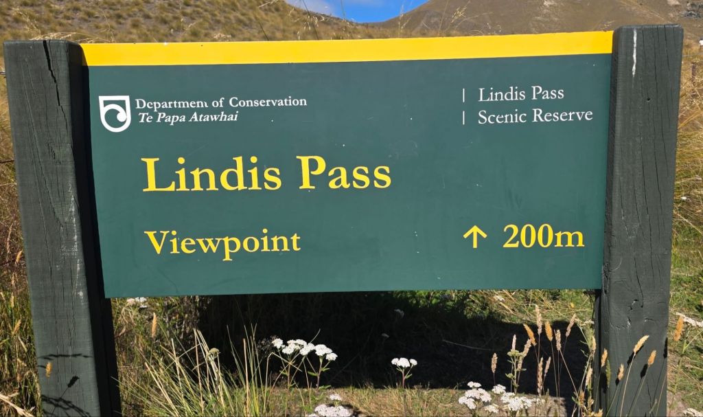
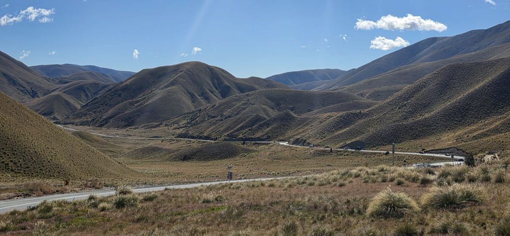
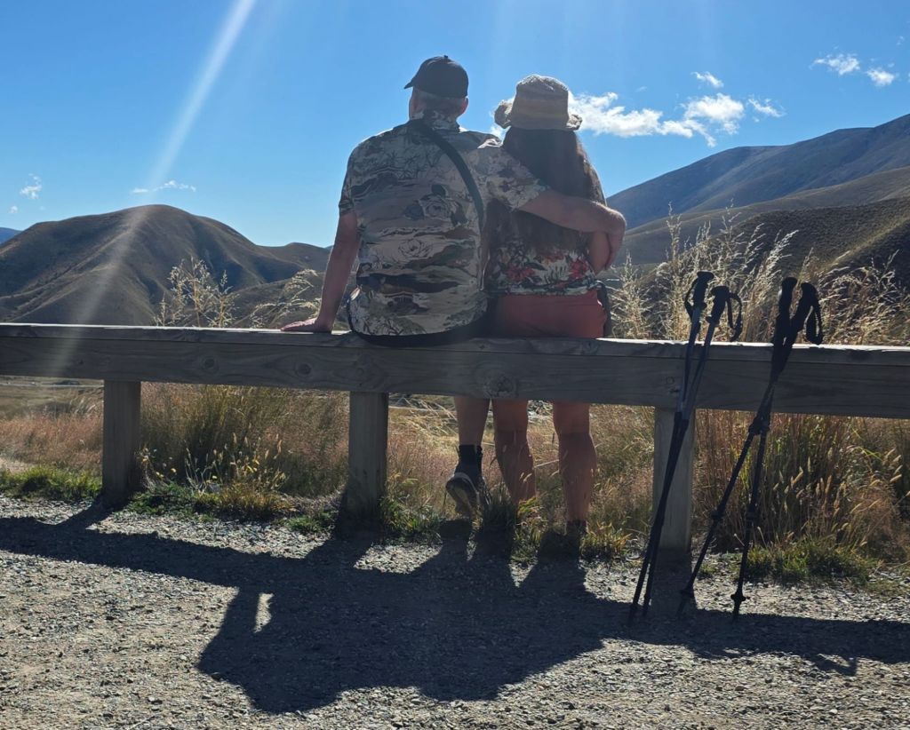
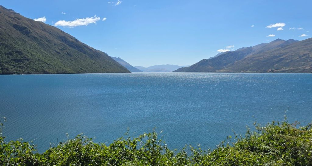
Lindis Pass and Viewpoint
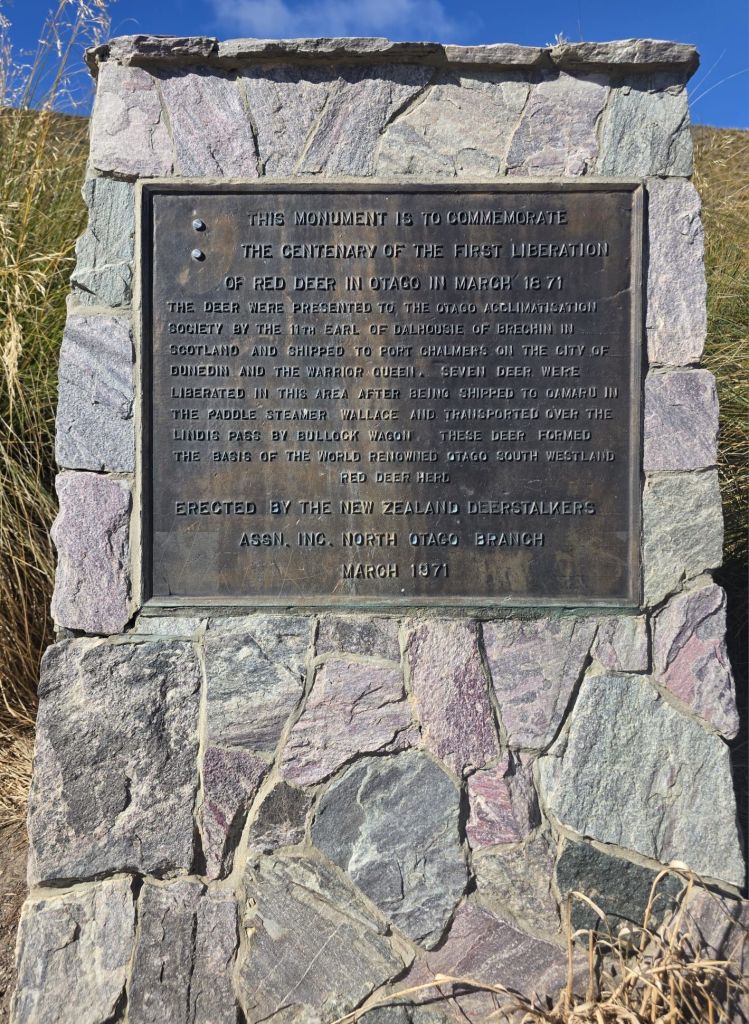
In the late 19th century, seven red deer were brought across by a Scotsman, then released over the Lindis Pass. These deer flourished and were the basis for the Otago South Westlands herd that is famous today. On our travels we have been surprised by the number of red deer being farmed. Unfortunately, we didn’t see any in the wild but they are huge with the stags even bigger and some with antlers bigger than me. The mountainous area that we were cutting through reminded us of the Purbecks back in Dorset. Whereas most of the other mountains we have seen have had a Scottish Highlands, Welsh Snowdonia or Western Irish feel about them with the rugged edges and snow- covered peaks.
Where are you
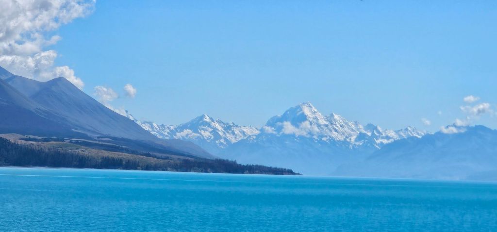
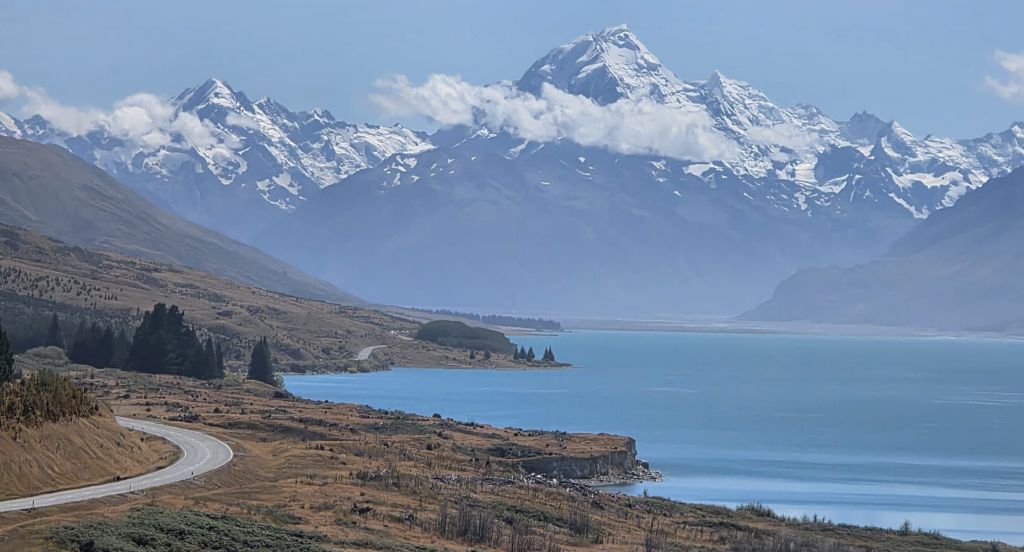
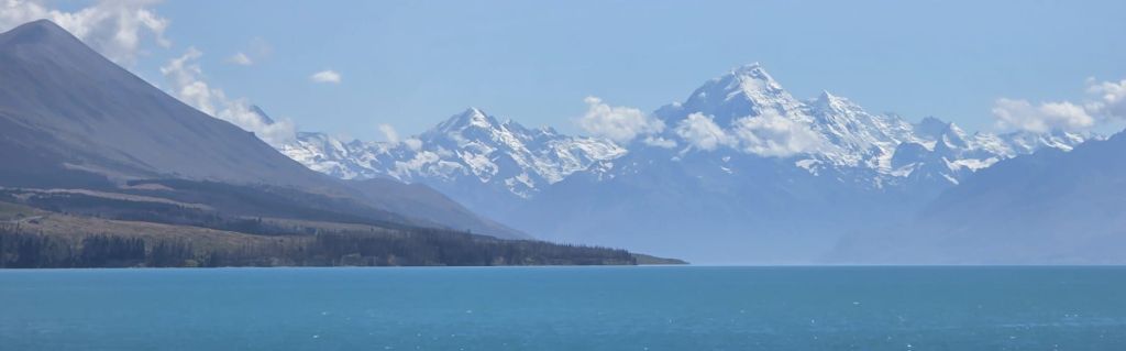
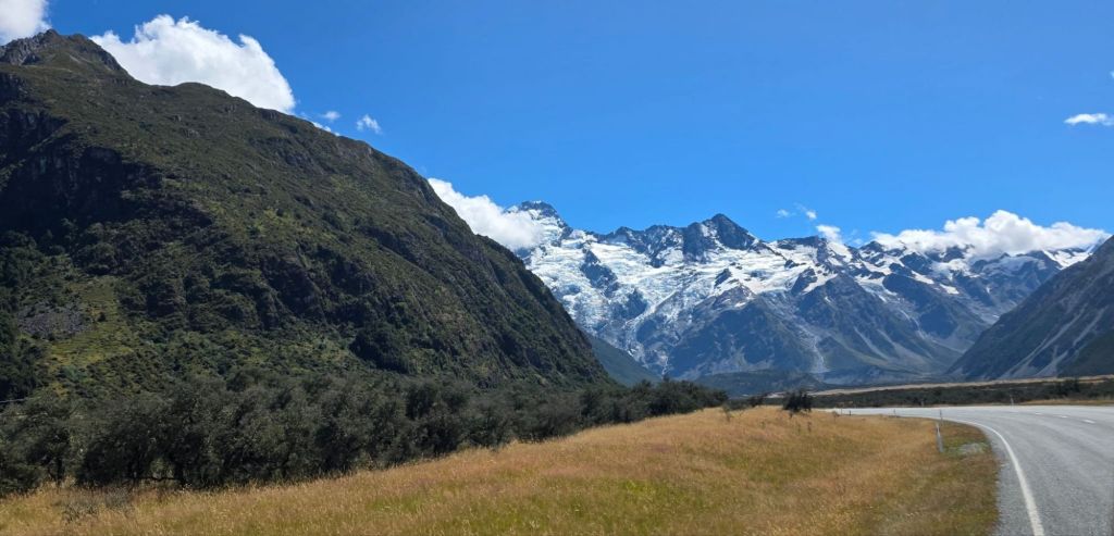
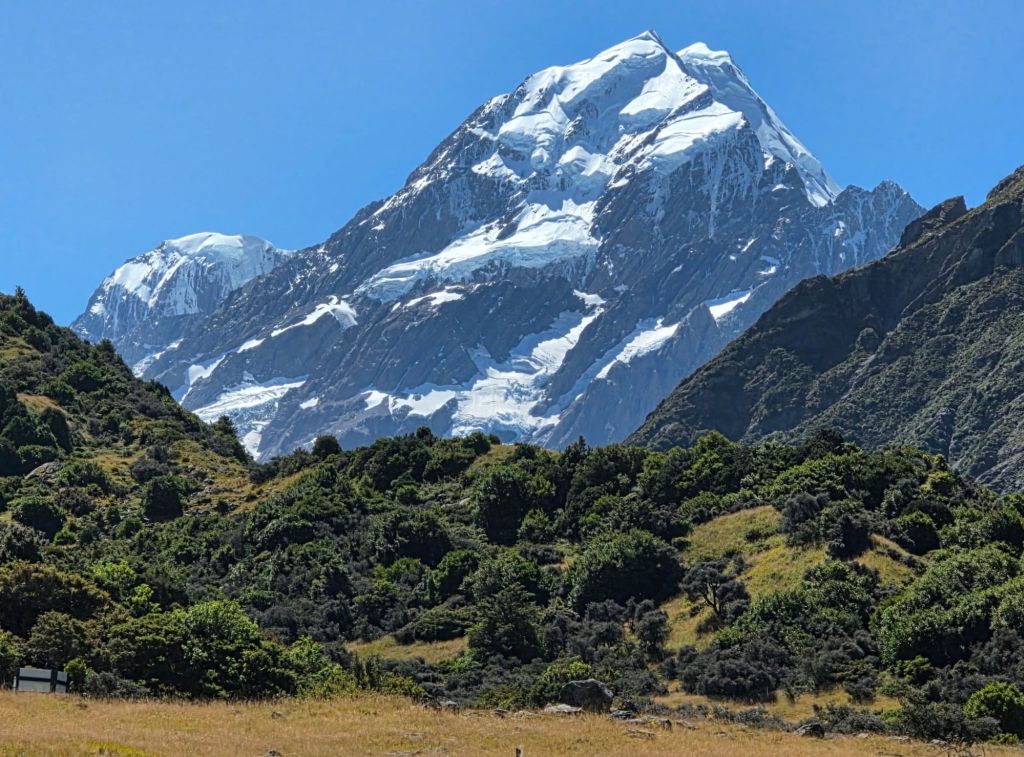
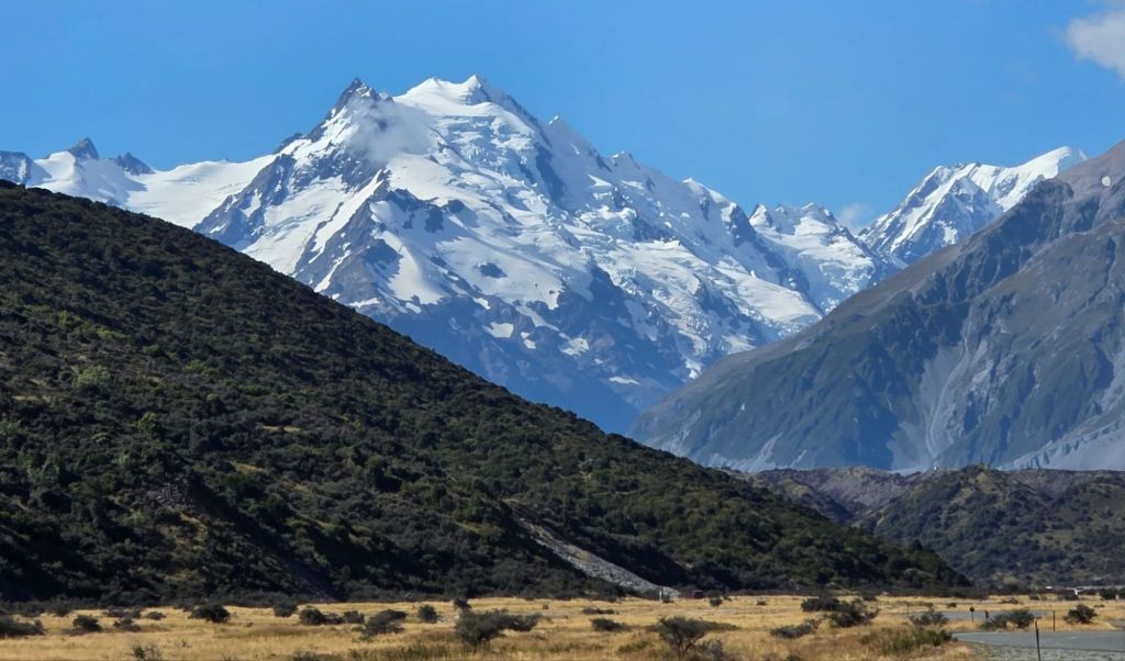
We carried on our journey and kept seeing it in the distance until we came to Lake Pukaki for a magnificent view of THE BIGGEST ONE.
Here is where the ‘Laketown’ was placed in The Hobbit: Desolation of Smaug with the ‘Lonely Mountain’ prominent in the background. The glacial lakes from the surrounding Aoraki/Mt Cook Range give Lake Pukaki it’s vibrant blue colour. Other scenes around the area included many aerial shots of the range for the Misty Mountains and the ‘Warg Chase’ was also filled near Lake Pukaki.
$2 toilet and $55 salmon
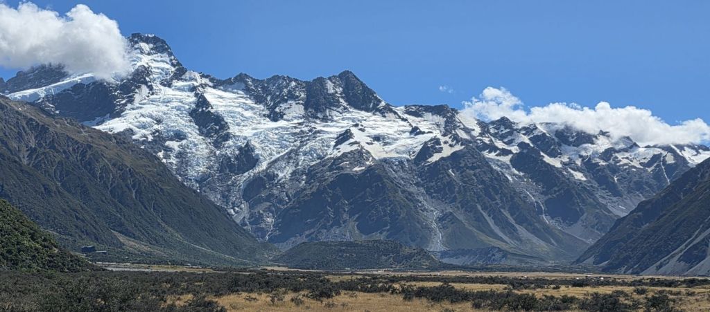
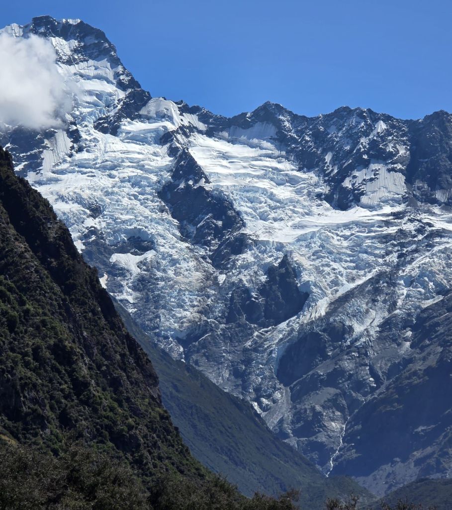
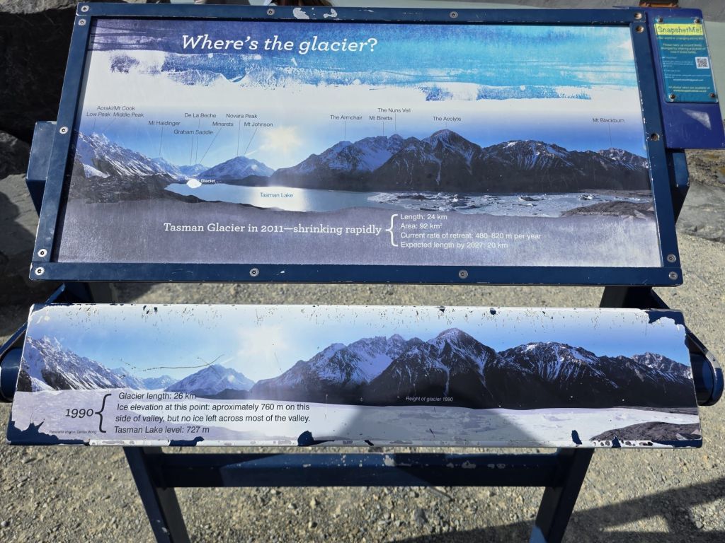
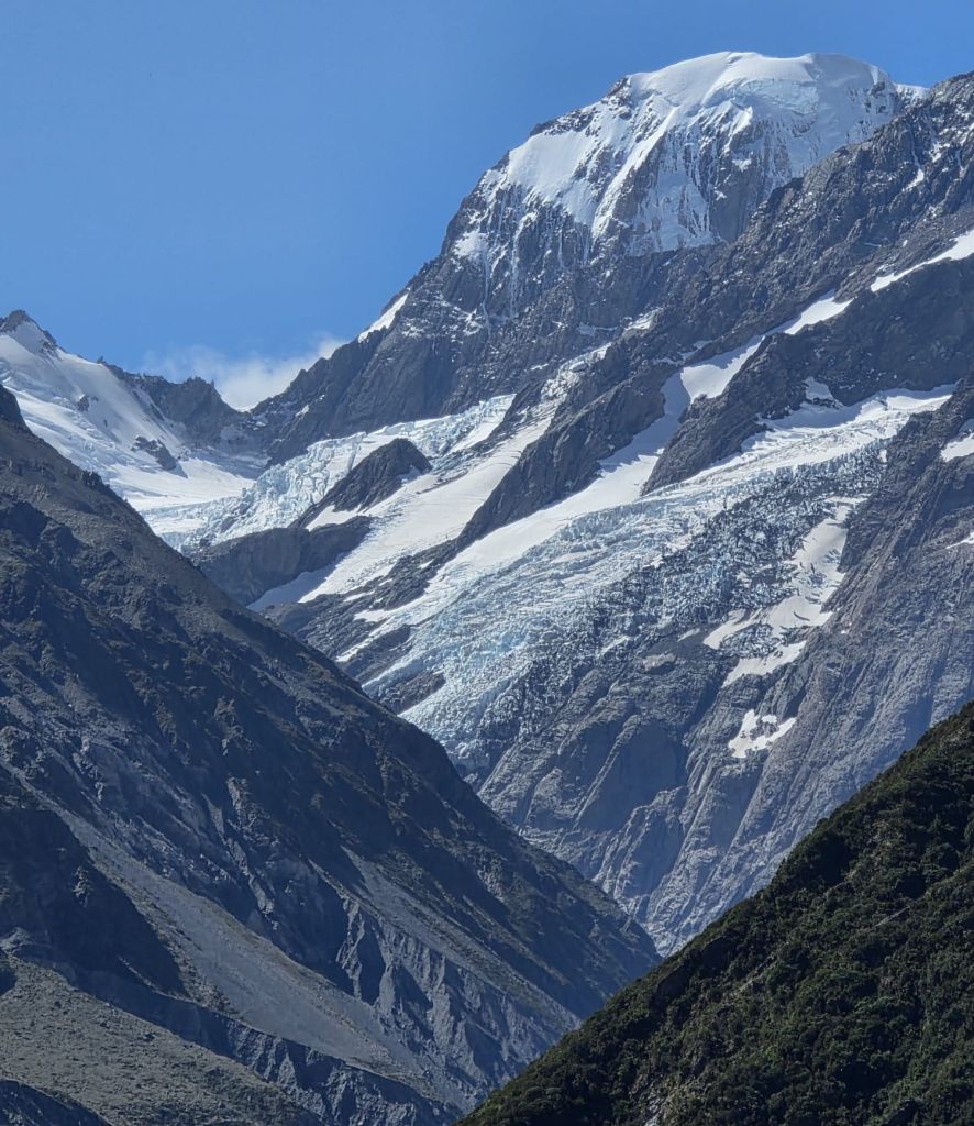
Punatahu visitor centre is on the lake and although there is free parking it would be a $2 fee for the toilet, which already had a long queue. Next to this block was a shop with an even bigger line selling glacier salmon at $55 for a small tub. It was safe to say we didn’t do either but did take some fantastic pictures of the lake with Mt Cook in the background. Mt Cook is the highest mountain in all New Zealand standing at a whopping 3724 metres (12,218). That’s two and a half times Ben Nevis. The whole range towers over the countryside below and that is where we headed next.
Moving camp
Up, Up and Away
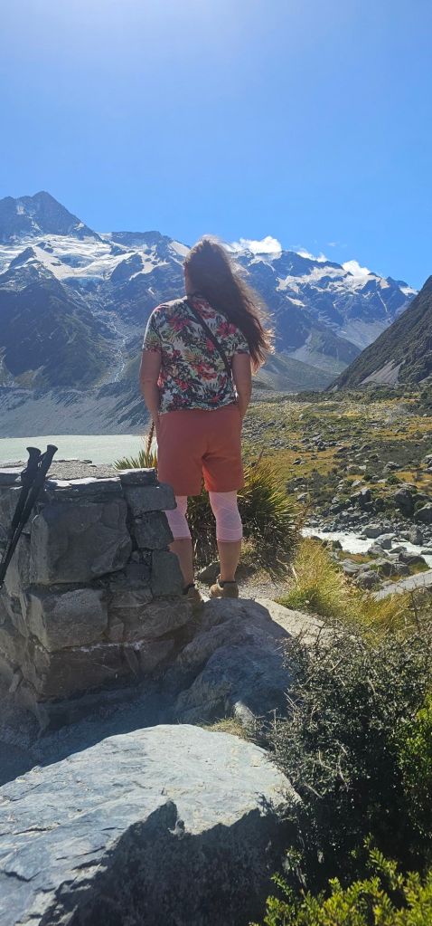
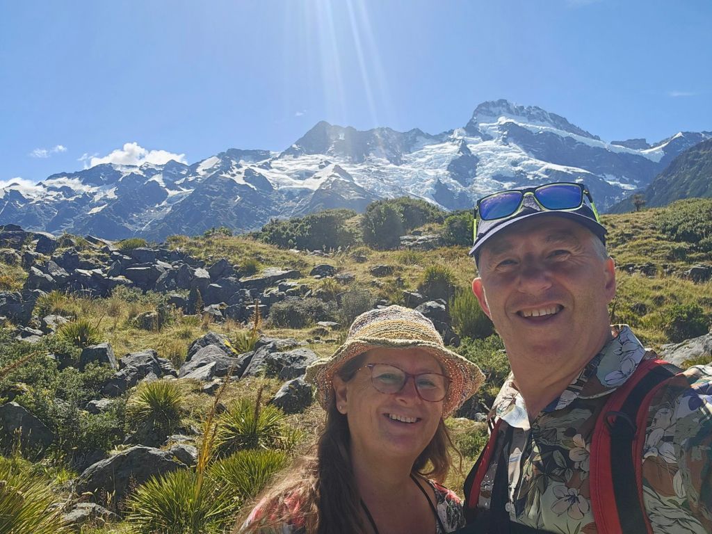
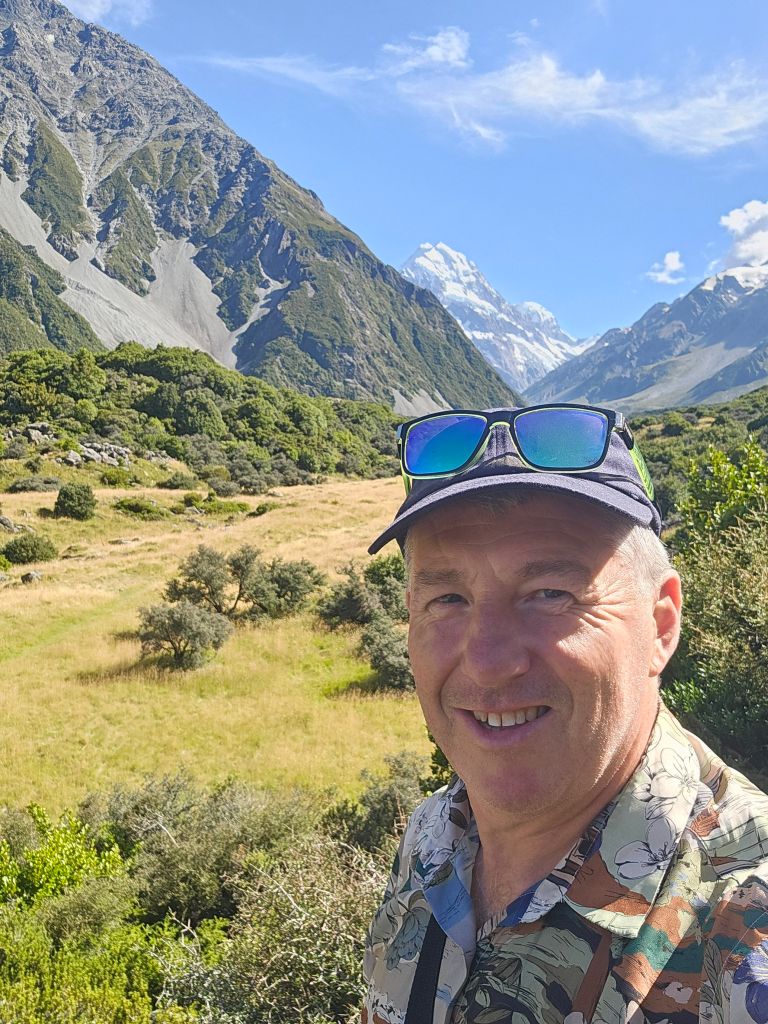
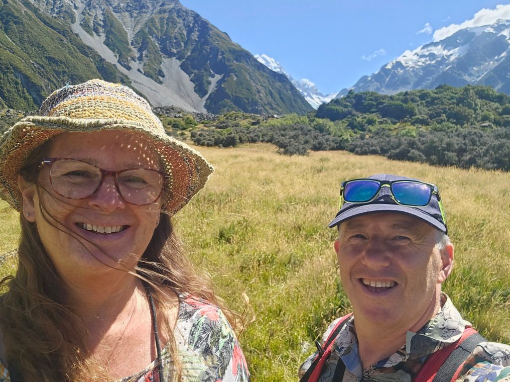
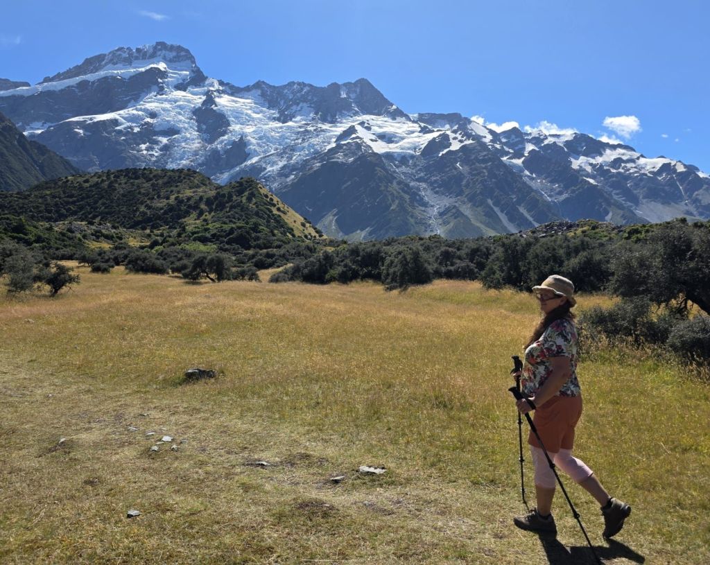
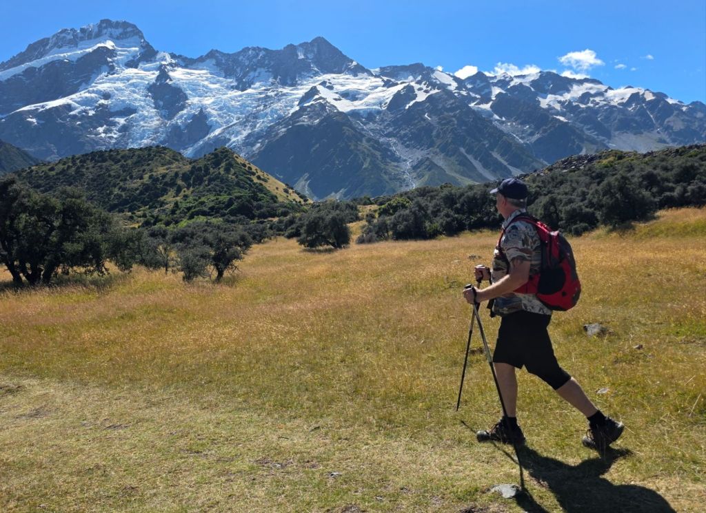
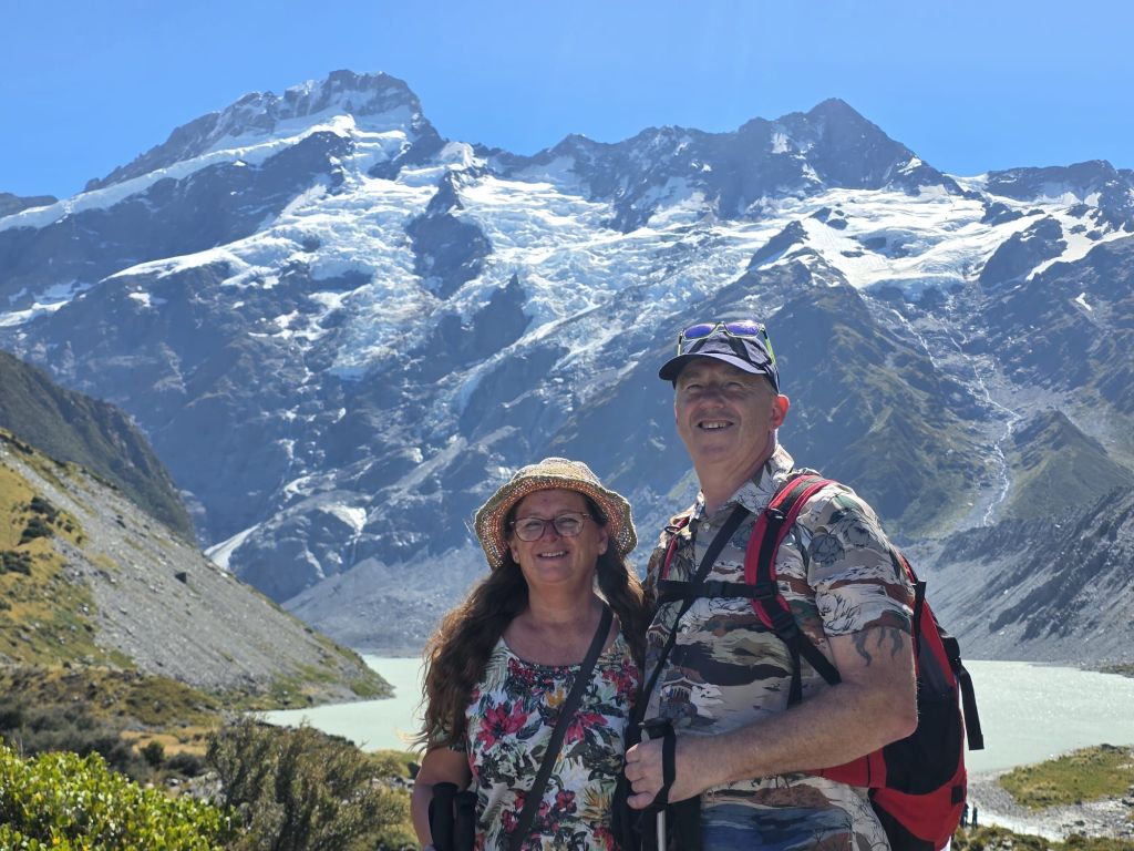
Now we had it firmly in our sights, it was time to get up close and personal. This is where we wanted to be trekking the mountains. Of course we do not have the equipment or the stamina to do this so we are off to the base of the mountain range and our next location The Hooker Valley Track. We managed to get parked roadside before the $25 parking started with only a few extra metres to walk. The carpark was packed anyway so they were definitely making their money for the upkeep today.
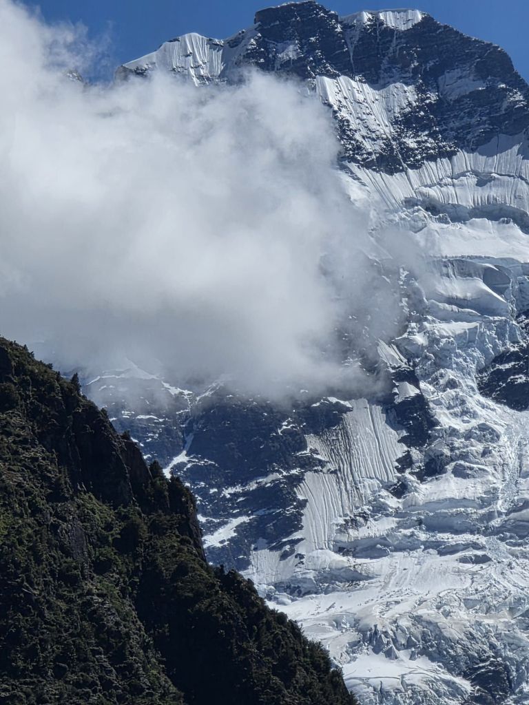
Close but no cigar
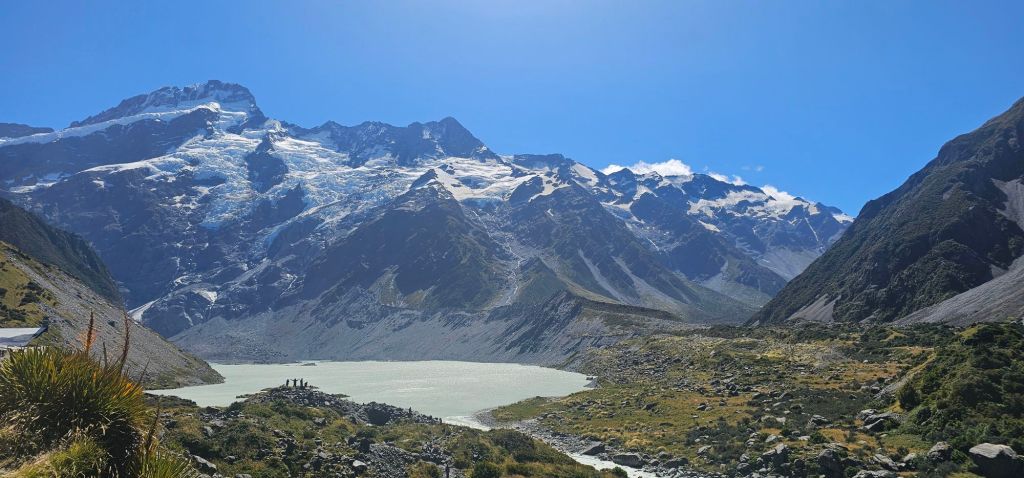
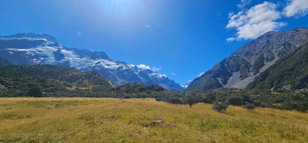
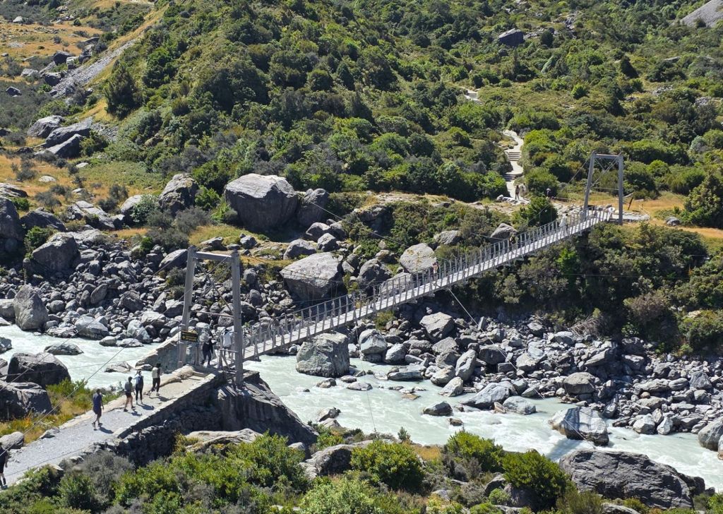
Like a lot of New Zealand, this area hasn’t escaped the adverse weather conditions of the past couple of years. The area around the second swing bridge had been washed away in the floods of 2019. Then in 2025 even more of the banks were washed away. The local authority deemed the bridge foundations unsafe and have now embarked on a new state of the art 189 metre swingbridge to be ready in Autumn later this year. This meant there was access only as far as the first swingbridge.
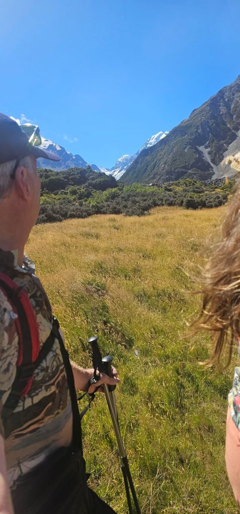
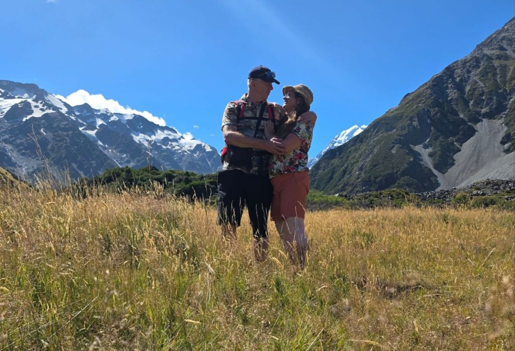
Once more, undeterred we set off on the track. The track had now been cut from a 10km to 4.5km hike. Even so, this was one of the busiest treks we had been on with people of all ages and from many countries on it. Still feeling the effects of the rafting on my knees and covered in Tiger Balm we made it up to the highest viewpoint a couple of kilometres in. From here it was down a steep hill to a jam-packed bridge with a queue each side of people waiting to cross. The view from below didn’t look half as impressive as from where we were currently standing as there was no smokey mist on the mountains. We decided we would return and do one of the other treks while skies were blue and clear.
Fallen but not forgotten
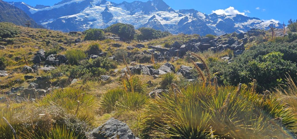
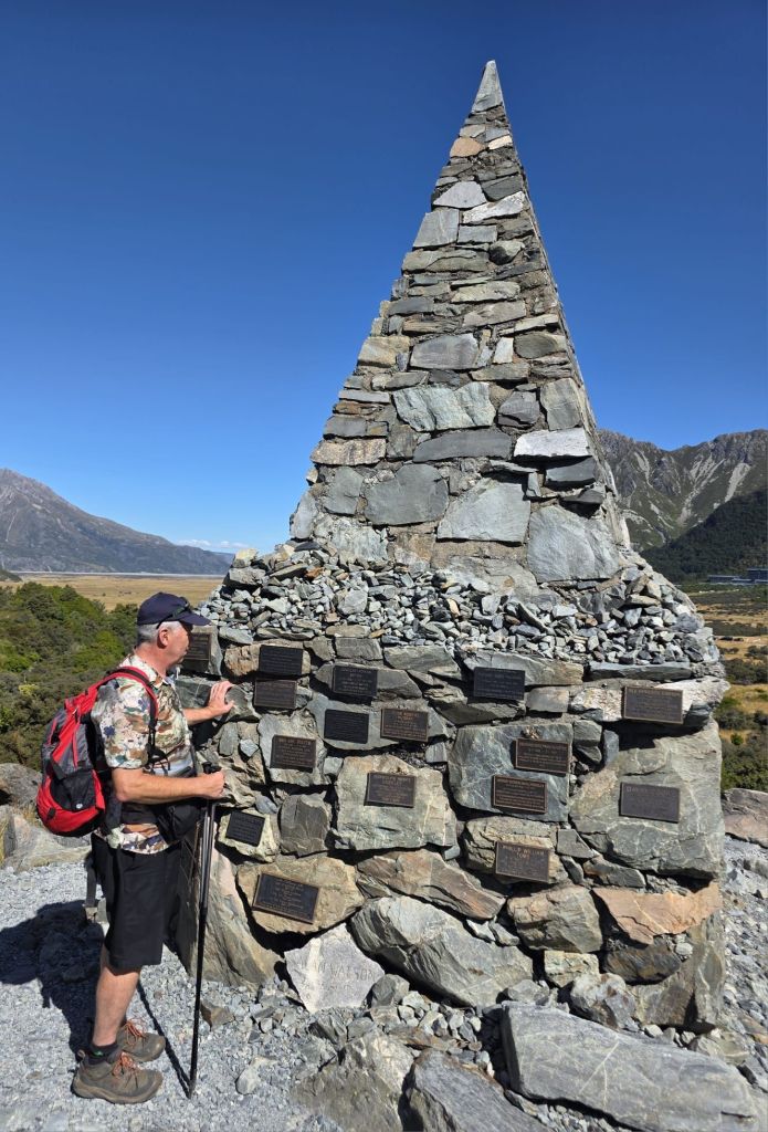
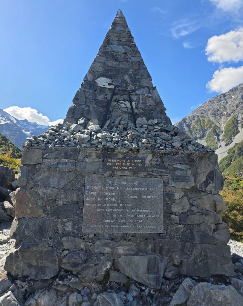
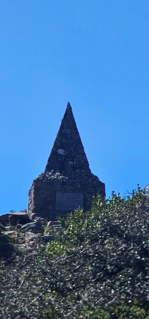
On the way back we stopped at a memorial for people lost to avalanches, severe weather, falls or other reasons on the mountain range. There were an awful lot of plaques not just for Mt Cook but many of the other mountains including Mt Sefton. It was up at the memorial that we heard an almighty rumbling in the distance coming from behind the mountains to our left and in the direction of Mt Sefton. We assumed it was an avalanche as there were warnings there could be in the higher peaks. Sure enough it was not long before a couple of helicopters appeared. One was carrying a large package and both were heading in the direction of the noise we had heard. After a while one returned with what looked like a stretcher hanging on a winch. Let’s hope everyone on that mountain survived and are well.
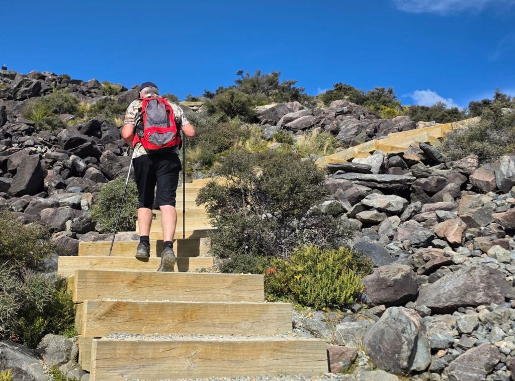
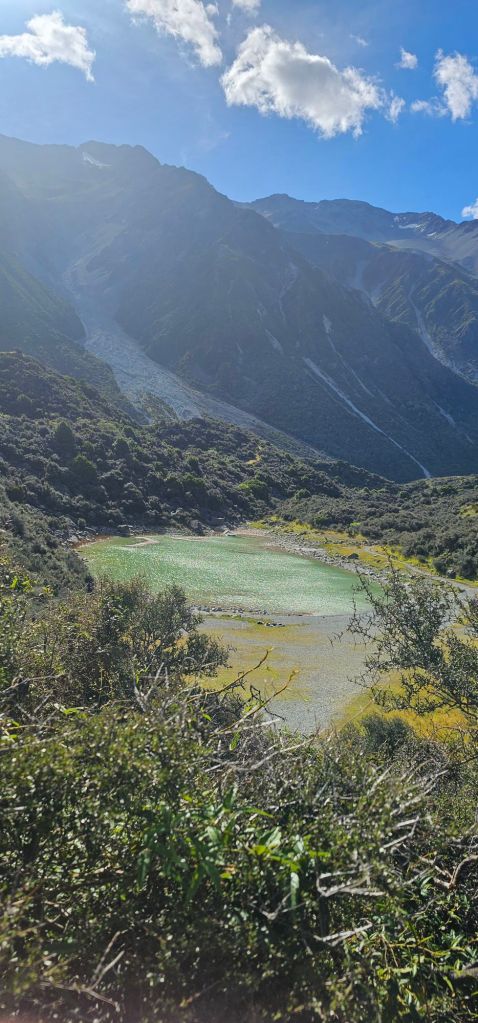
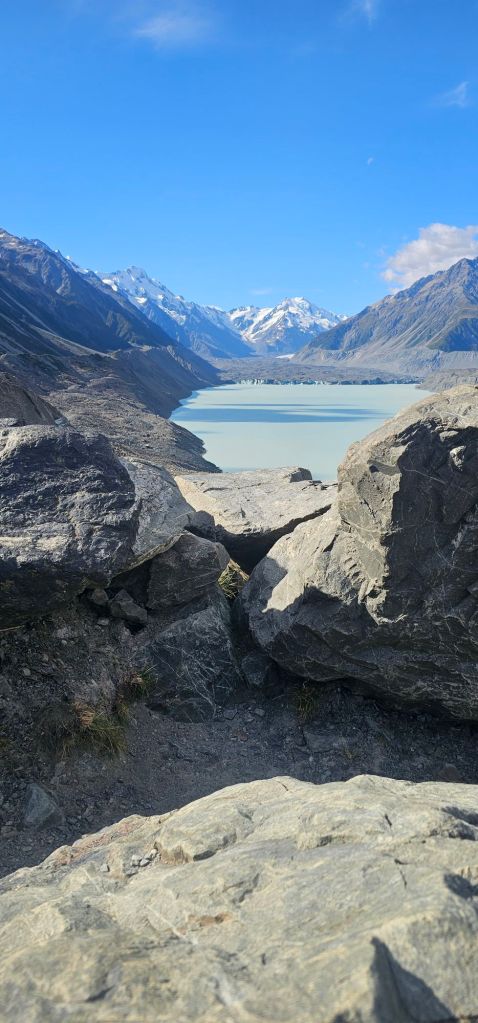
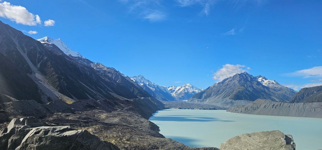
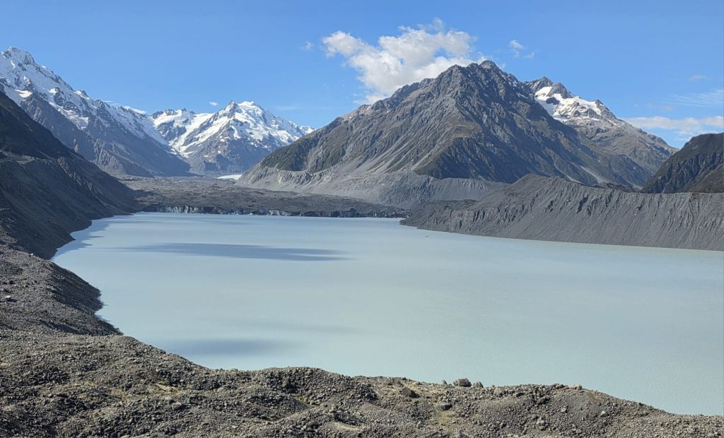
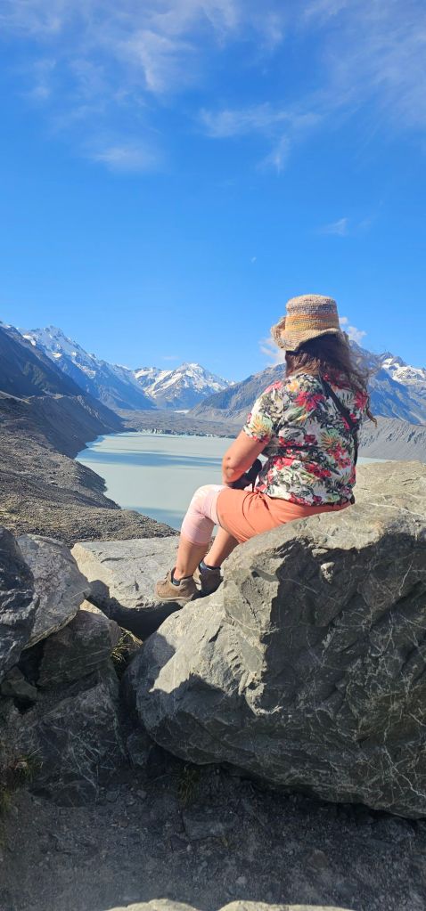
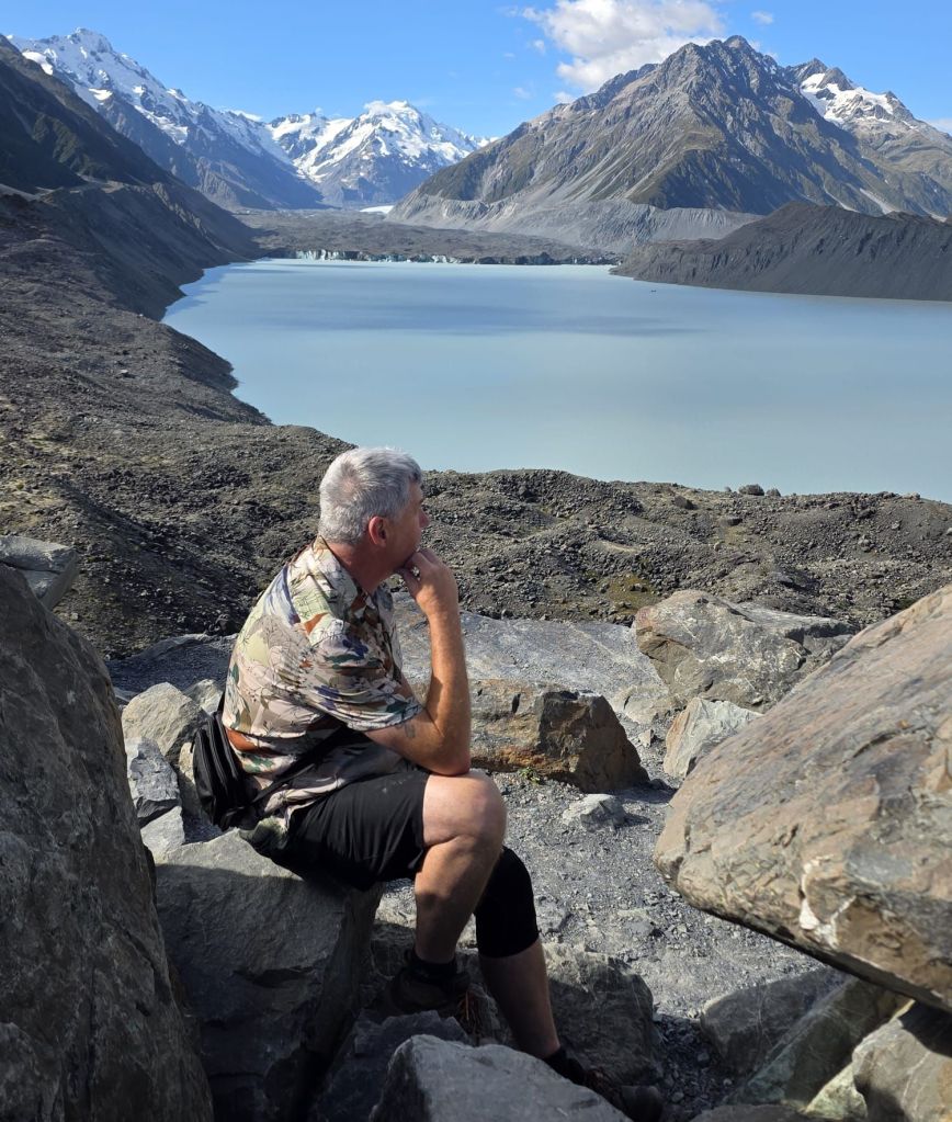
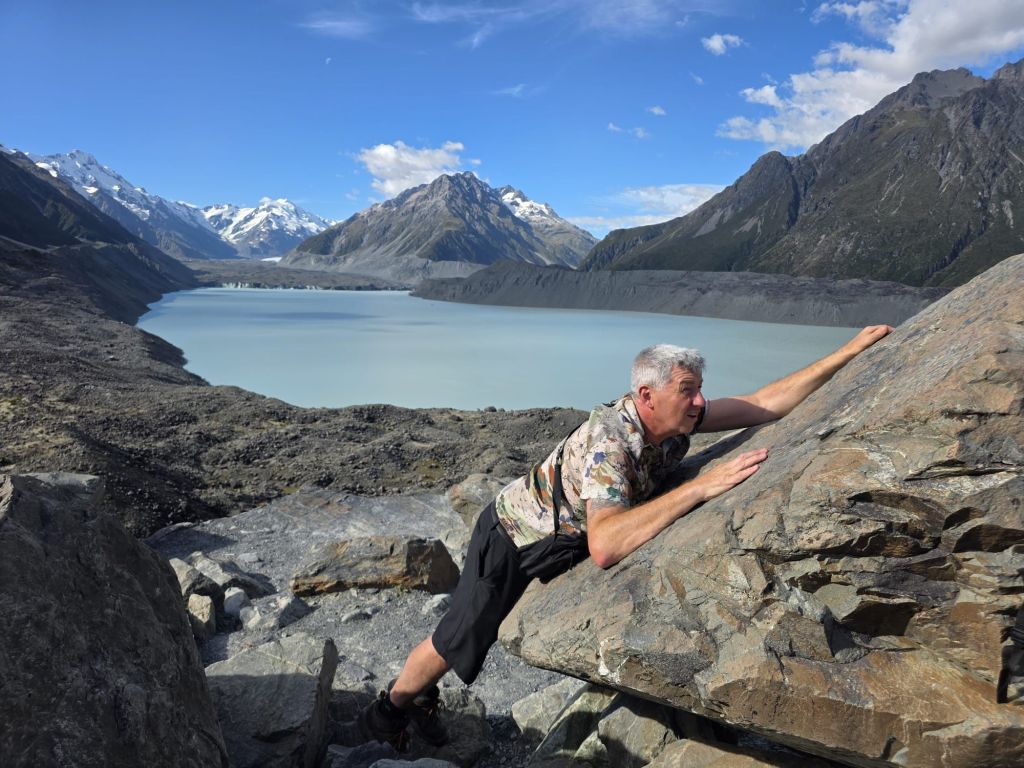
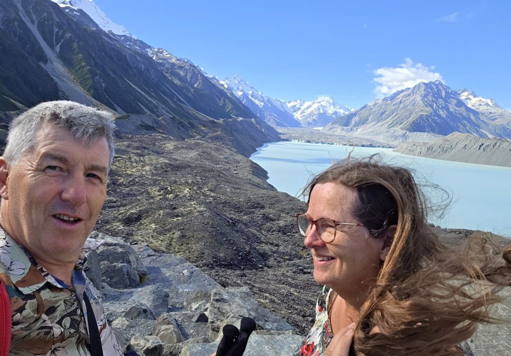
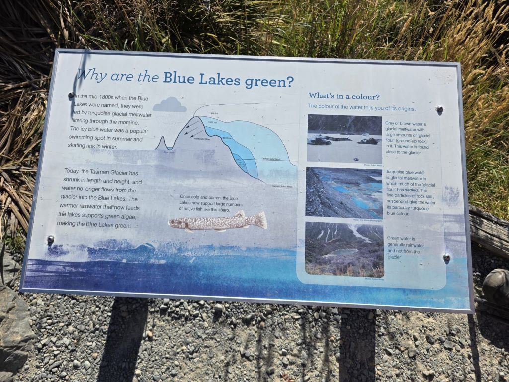
Green is the new blue
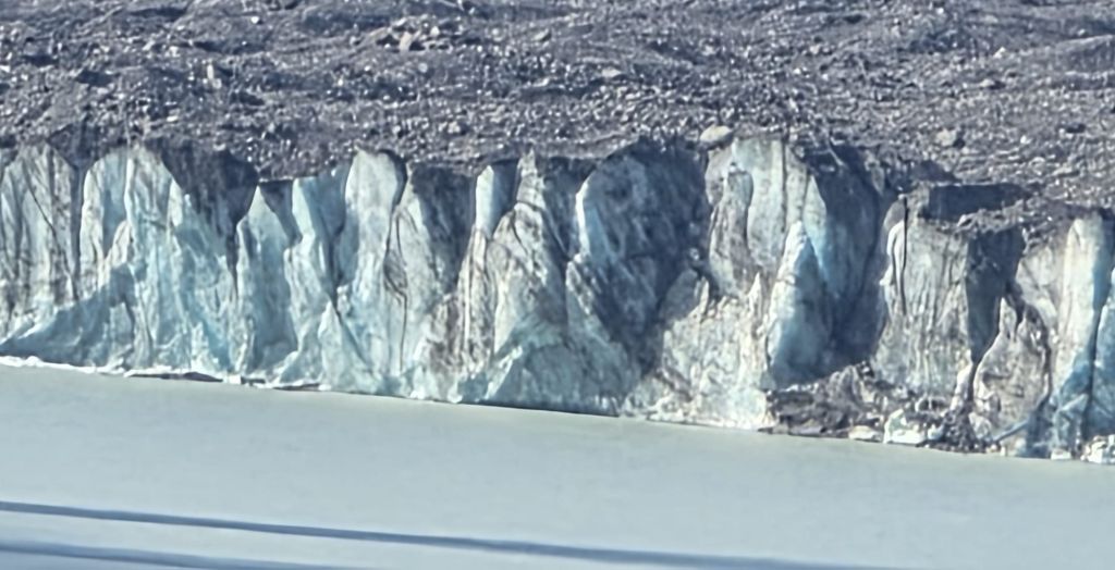
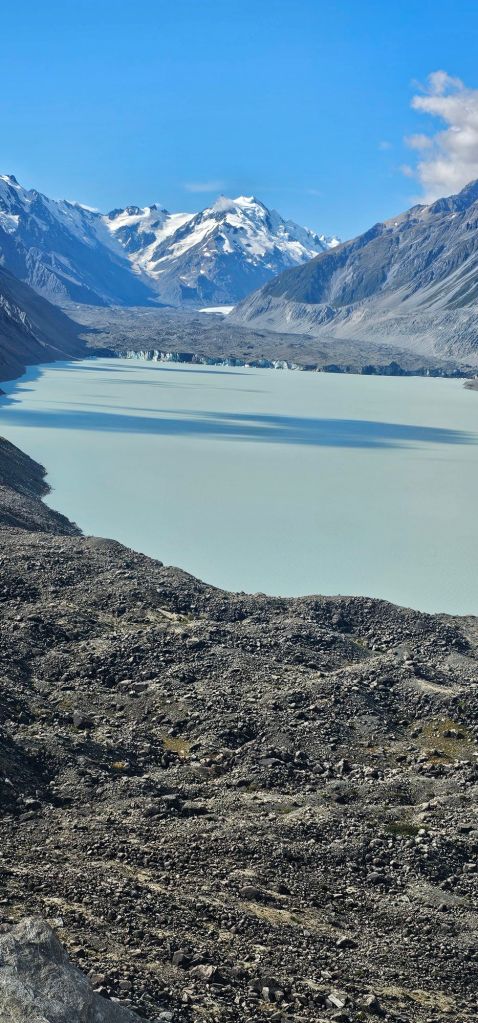
We arrived at the Tasman Glacier and Blue Pool treks a few kilometres down the road. Surprisingly, this had a few spaces but wasn’t charging to park. Once again though, it was busy with people going off in different directions for their trekking. The route we were going to take was by far the most popular and looked to be recently upgraded to mainly steps rather than a gravel track mentioned in many reviews. The sign informed us the old path had been damaged in a rock slide. Up we climbed using the steps, until we came to a fork in the road. We took the left fork to come out at the blue lake. Unfortunately, but we shouldn’t have been surprised, below in the valley we could see the path had been closed off with ropes and signs. Retreating our steps we took the right fork and came out on the most beautiful viewpoint with the lake below us with the Tasman Glacier in front of us a few kilometres. To each side of us were mountain ranges, making this look picture postcard idyllic. This is why there were so many people. One couldn’t help wonder at the marvel this viewpoint had when the glacier reached the lake a hundred years ago and the water was the exquisite turquoise colour that that New Zealand is renowned for.
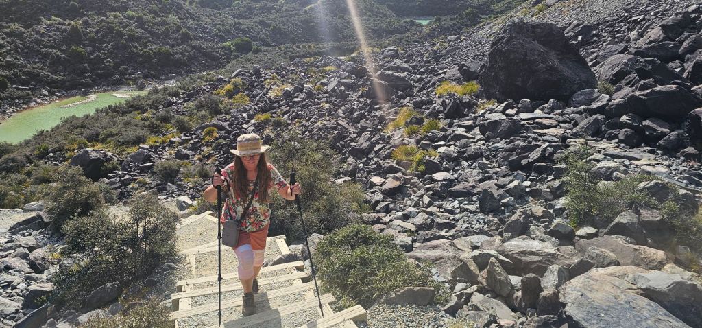
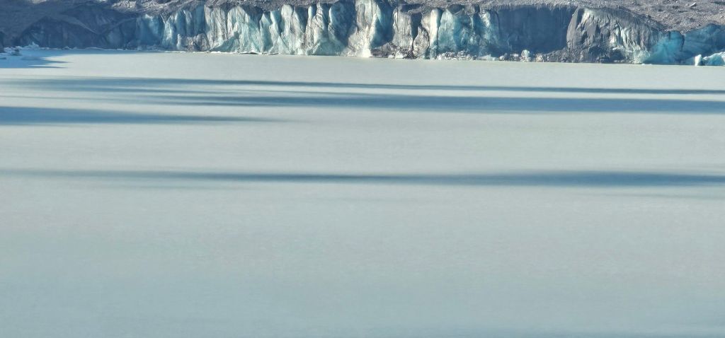

Changing colour
The Tasman glacier used to feed the Blue Pool, but since it has receeded the water runs off to another lake. The green lake below us, still called the Blue Pool is now filled by just rainwater and not the glacier water.
After another full-on day, we headed for our overnight freedom camping spot at the side of a very noisy river, though we got tucked far enough away not to hear it.
A nice curry dinner, hand of cards and some more chocolate topped off an excellent day.

Leave a comment